How great it was to break out the tent, load up the car and drive west to the mountain – a destination not visited for way too long.
After nearly 3 months of living my day-by-day life where internships at newspapers, working at the bookstore and constantly training for fall marathons occupy the majority of minutes throughout the day, Mel and I were finally able to both get two days off from everything.
Some people aim to only complete a 14er and move on. Not us. We had planned an entire day that include a hike up Bierdstadt, a traverse across the (in)famous Sawtooth, an ascent of Mt. Evans, a descent through a gully the dips nearly 3,000 feet nearly straight down, and a couple bushwhacking miles through a bogged area known as the Willows.
On our “weekend,” which happened to be Thursday and Friday, we drove two hours southwest into the picturesque village of Georgetown. This town, a rest on the way to a camping spot 3,000 feet higher, is seemingly frozen in time. It belongs in a black and white movie with its 150-year-old architecture and seemingly candyland-ish color schemes.


We walked around for a bit since we had some extra time, and what a trip through time it was. Everything was so central – so peaceful it seemed. From the school and church to the play structure and fire department, it was as if we were walking down main street in a movie, though I am not sure who had the idea to put high voltage near a water feature?

It was soon time to go up, and what would summer be without a construction project even at 10,000 feet. We received an escort up the mountainside and romped over the dirt mounds and rock piles. If I would have gotten stuck, at least we had company behind us... and yes he was moving right on my tail.


The road soon paved out and we were inching closer and close to Guenalla Pass where the trail began at 11,600 feet. The view from here is simply stunning, a recurring theme to present itself throughout this quick day trip.

We soon found a nice spot to park and car camp for the night just a mile from the beginning point of our hike. Nestled near a stream, we soon had camp set up, food figured out and a relaxing evening of fire-side chat planned.


It has been too long since I have car camped, and it is not ok. I blame it on not having a car for so long and not being back home to go like I did in high school every month, but I plan on doing it a lot more in the near future. It is so much more relaxed not worrying about packing and planning for a week long backpacking trip, though one of those needs to be on the agenda soon.

The night was early, and with plans of waking at 4 a.m. To get to the trailhead, we were soon asleep.
Thanks to the obnoxious ringing of the Beatles alarm clock I brought – a new tradition for overnight trips I think – we were soon on our way up the west side of Mount Bierdstadt. This hike was the easy part of what would begin our epic adventure for the day.

As we began, a runner whom we can only imagine as a semi-professional or sponsored athlete blew past us running up the 2,500 feet of rock and trail only to come right back down. His form was perfect – give me a few more months haha.

The sawtooth is the jagged part between left and right sides... go across that :)
Watching the sun rise over the rocky ridges from such a beautiful and majestic environment is unlike anything I have ever seen. Each time it happens, it seems more and more impressive. This was no exception as the rays first draped the peaks to our west and soon bathed us in its rays only later to leave more burns on my face.

We paused often. For some reason I wanted to take more pictures than usual. I guess there are worse things in life.


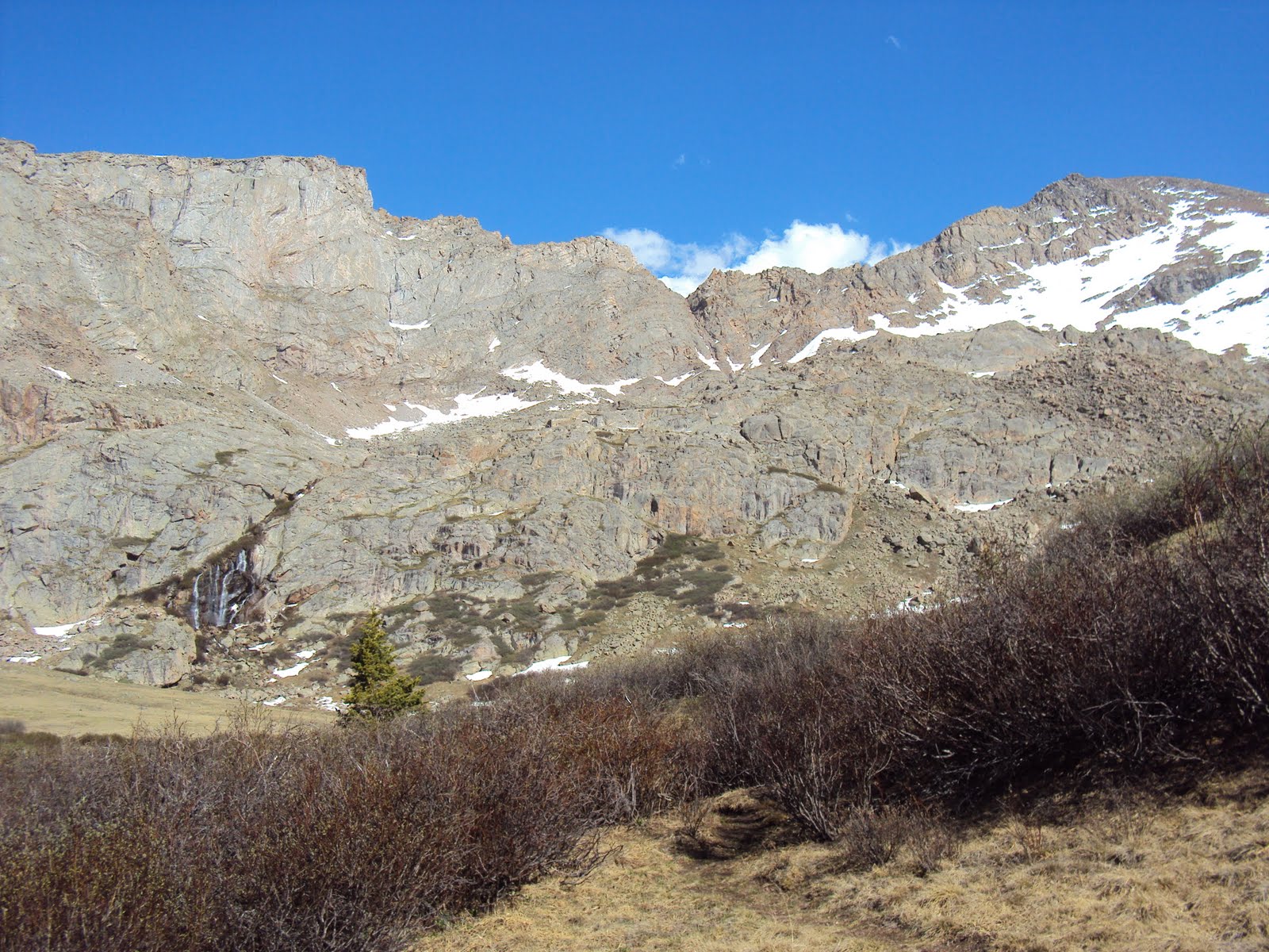
By 8 a.m. We were nearing the peak at 14,060 feet. There were only a few small snow fields to negotiate, and the rocks were relatively easy class 2 terrain. The most difficult part of this initial 3 miles of the hike was the ice from the small streams that run across the trail, but even this could be done by many average hikers.

Warm temps and clear skies greeted us, and the views, even from an “easy” hike like this, were equally as stunning as anything I have ever seen before.
We talked to a couple other peak-baggers and signed the registry while eating our breakfast of Clif Bars and water and planning our route for the remainder of the day. We were most concerned with the traverse, a class 3 climb that ultimately turned to class 4 by the time we were done.
We plotted our route and were soon descending sharply into an opening valley.

Parts of it seemed ok, but the repetitive ups and downs and constant rock scrambling take a toll. We descended through the boulder field about 400 feet while eying the trail just to northwest. We planned to bi-sect it through a snow-field – “mistake” number 1 for the day.
I say mistake lightly.
Soon we were back with the main “trail,” which was more like a guidance or cairns dispersed along the ridge – not a trail at all. We made our way along the steep apex of 2 worlds, trying carefully to not freak out about the thousands of feet of air below us on both sides.

A marmot that had followed us up came out to say hi

It wasn't long before we made a turn too early and found ourselves back in the snow waist deep, angled snow field.
“Mistake” number 2.
This isn't the kind of snow you play on – it is the kind that you can step wrong, begin sliding and not stop until you hit the lake 2,500 feet below.
The idea of this was amazing, terrifying and beautiful at the same time. Soon though we found ourselves stuck. We had made our way to an island in the sky it seemed, using careful teamwork to get across the unstable slope. The snow went nowhere on either side of us, and the rock face, which we estimate as a 5.5 top rope climb with drops to make you dizzy, was all we had to move on.

To make matters worse, we realized we had spent way too much time on this ridge. The time was nearly 11 a.m., and the clouds were building above – not the situation you want when you aren't even close to being in a safe spot in the event of lightning. We had to keep moving, but the questions was to where?
So we did climbed. Up.


Grasping each crack with our lives and trying not to look down, we soon found ourselves back at the cairns along the ridgeline – good news until we realized just how harrowing the the remaining portion portion looked in person.


Hugging the wall and negotiating the loose rock and dirt, we went up. And up. And up until the Sawtooth was able to be checked off of our to-do list.
To be fair, each person who said that it wasn't as bad as it looked was absolutely right. The worst part had been our little detour minutes before, and this was merely exposed. There was plenty of room to walk, believe it or not, and it really was a fun traverse across the sky as promised. Some tougher scrambling, yes, but definitely tame compared to what our future trips hold.
The clouds had cleared, and our plans to summit Mt. Evans today was still on the agenda despite the set-backs earlier in the climb.
Hugging the ridge line and moving towards the summit of Evans we hiked. It was a walk at this point through open boulder/grass fields that even contained flowers of the most rugged type at 14,000 feet.


We came from the peak on left, dipped down and then up the spike on the right
The rock scrambling continued until after another 2 miles of climbing, we reached the summit at 14,264.

This was not nearly as glorious of an achievement. I blame it partially on the tourist trap it had become. While boasting to have the highest paved road in the country, with it comes the hoards of people who know nothing about a mountain or even basic trail etiquette. They don't even move as two exhausted hikers try to make the push to the peak.
So it goes.
After a short lunch of tuna and bars (tuna bars seem like a REALLY good idea come to think of it...), we were heading down the cairned route to the opening of a gully that dips back to the area near Guenalla Pass. The steepest portion of the day was here as we inched our way down the tough terrain. Of course, a fun hike is not complete without some sliding which we soon came to appreciate.

It wasn't long before we were racing through the snow-fields, sliding as far as possible and hoping to keep the snow out of our boots before we were at the flat-land again,
It wasn't over yet, of course.
After pausing at a creek for pictures and water of the purest and cleanest sort, we soon found ourselves pushing through ankle-deep mud in a bog that attempts to swallow up anything that steps near it. Plus, we were bushwhacking through willow bushes taller than us that were unforgiving to visitors.
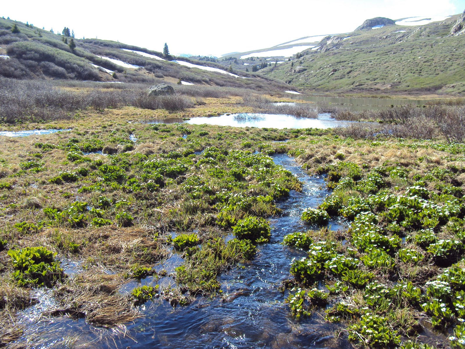


There was no trail through here – only small tributaries that go to a complex array of dammed up beaver ponds.


Veering south around another mountain, we were inching closer and closer to the main trail we had begun more than 12 hours earlier.
At nearly 6 p.m. We made it back to the car, changed and ate before embarking on the two-hour drive back to our “real” lives.

That is, until next week when we do a couple more 14ers on yet another adventure.
Reflections:
I mentioned mistakes earlier. Mistaken routes. Mistaken timing. At the time, they did seem like mistakes, and for a moment, it seemed as if everything was about to hit the fan... Hard. Things can crash down really fast, and we found ourselves in a dicey situation. Looking back, I am beyond glad that things played out that way. We traversed a suicidal snow-field more than once with spectators saying how crazy it all looked, rock climbed and pushed our bodies to the mental and physical limits and kept our composure. These little mistakes and the ways in which we handle them are how we train for the big issues that can come up while negotiating a tougher mountain. I cannot wait for that day to come.
Time spent:
We looked forward to this, like all of our trips, for weeks. It had been way too long since we did an overnight trip anywhere (since Canyonlands National Park). It is crazy how just looking at a guidebook that has everything listed about every mountain can give us an idea. Better yet, it is amazing how we can just run with that idea and make an epic trip out of it, caring so little about where to be and the worries surrounding us back home.
Looking forward:
We are hoping to bag 20 14ers throughout the summer, and this seems totally possible if we can continue these quick trips. Everything is so close to us, and having the mountains in our back yard is something I feel ridiculously fortunate about. So many adventures lay only an hour's drive from us. Thank you, Colorado.